NGDC Deposited Data
Type of resources
Topics
Keywords
Contact for the resource
Provided by
Years
Formats
Representation types
Update frequencies
Scale
Resolution
-
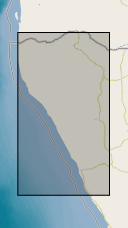
Wind, sediment transport and surface/saltation data collected at Huab River Valley during a field campaign in September 2019 to investigate saltation on gravel and sand surfaces. Surface/saltation data: This is terrestrial laser scanned (TLS) data collected over sand and gravel surfaces during multiple days when saltation was active, on a surface approximately 8 m from the TLS, perpendicular to the wind direction. The data is raw point cloud format in text columns of x, y and z coordinate data. Files are named *_^_scan& where * is the date that the data was collected in yymmdd format, ^ is surface type (sand or gravel) and & is the scan number. Each data set uses the same coordinate system. Data can be viewed in any spatial software. Wind and sediment data were collected from a fixed point on each surface, directly downwind of the TLS data. The data is in csv file format with column titles and can be viewed in any text or database software. Data include hot wire measurements at different heights, Wenglor counts, sensit counts and 3D sonic measurements on some days. Sonic data is at 10 Hz, hotwire data at 10 second intervals, transport data is given within both datasets.
-
The data set contains two separate items: (1) Global carbon dioxide removal potential of mine tailings, which includes (a) List of selected silicate-hosted mine tailings (classified by their targeted commodity and typical host rock) for initial assessment of CO2 removal (CDR) potential; (b) Estimated annual and cumulative production (Mt) of suitable tailings for host countries for the years 2030-2100; (c) Assessed deposit types and associated tailings mineralogies; (d) Summary kinetic data for typical targetable minerals in suitable tailings; (e) Effects of mineral compositional (and end member) variations on dissolution rates under unimproved conditions (Wr-Neut); (f) All compiled mineral data used in the GGREW global assessment study and other complimentary GGREW studies; (g) Estimates of dissolution extent over time (on decadal timescales of up to 70 years) for a theoretical 1 kg of tailings material at typical grain sizes and unimproved conditions (using Wr-Neut); (h) Total cumulative CDR (tCDR; MtCO2 as alkalinity); (i) Estimated CDR capacity (cumulative for the estimated annual tailings production at 2030 (sCDR) and total cumulative CDR (tCDR) as alkalinity for 2050 and 2100) for select countries that produce and host suitable tailings; (j) CDR achieved annually by country (2030-2100), under unimproved and improved conditions; and (k) Sources of information for modal mineralogies, commodity production to tailings production ratios and typical grain sizes for each potentially suitable tailings material type. (2) Results of enhanced weathering reactor optimisation with two objectives, namely energy consumption and space (area) requirement, which include the optimisation output for calcite weathering using trickle-bed reactor, calcite weathering using packed-bubble column and forsterite weathering using packed-bubble column. For each of them, the data includes key reactor design parameters, the two objectives, and key process characteristics (particularly, mass transfer performance and mineral dissolution rates).
-
Data produced from NERC Grant NE/M001156/1 - Fe speciation data (FeHR/FeT, and FePy/FeHR), collected following methods outlined in Izon et al., 2017, Proceedings of the National Academy of Sciences (PNAS); % Carbonate, determined gravimetrically; d34SV-CDT for sedimentary pyrite, analysed by Iso-Analytical Laboratories, Cheshire, using standard EA-IRMS techniques; d15N of bulk rock, analysed by nano-EA-IRMS, following methods described in Polissar et al., 2009, Analytical Chemistry; d15N of kerogen extracted following the methods described in Zerkle et al., 2017, Nature, analysed by nano-EA-IRMS; d13C of organic carbon, measured on decarbonated rock powders by standard EA-IRMS techniques; %TN and TON % determined by standard EA-IRMS of bulk rock and extracted kerogen, respectively. Drill core samples were taken through the 2.7Ga old Manjeri Formation of the Belingwe Greenstone belt, Zimbabwe, which overlies more ancient gneissic basement with very well-exposed unconformity (Bickle et al. 1975). The Manjeri Formation, typically 50-150m thick, exhibits a deepening succession of facies (Grassineau et al., 2002, Hunter et al., 1998). It is directly overlain by komatiitic basalts and komatiites of the Reliance Fm., dated at 2692±9 Ma (Pb-Pb whole rock; Chauvel et al., 1993). The metamorphic grade of the Manjeri succession is variable, but generally remarkably low (Abell et al. 1981). Three drill cores were taken in the Manjeri Formation. The NERCMAR drill core has been described in detail by Grassineau et al., 2002. Drill cores A and B were collected some km to the north, in the upper Manjeri Formation.
-

Radiocarbon measurements on planktic and benthic foraminifera from sediment cores in the North Atlantic: Ocean Drilling Program (ODP) 983, SU90-44, MD04-2829, MD01-2461, and EW9302-2JPC Site 983 is located on the Bjorn Drift in approximately 1650 m water depth on the eastern flank of the Reykjanes Ridge. Hole 983A Position: 60°24.200'N, 23°38.437'W. Sediment core SU90-44 collected from the north-eastern Atlantic basin, near the top of a small abyssal hill, southeast of the Rockall plateau, 50°01'N, 17°06'W, 4279 m. Sediment core MD04-2829 collected from Rosemary Bank in the Northern Rockall Trough 58º 56.93’ N; 09º 34.30’ W; 1743 m water depth. Sediment core MD01-2461 was collected from the north-western flank of the Porcupine Seabight approximately 550 km to the southwest, 51°45’N, 12°55’W; 1153 m water depth, recovered in 2001. Core EW9302-2JPC recovered from the Rockall Plateau and East Flank of Reykjanes Ridge from the Flemish Cap in the south- eastern Labrador Sea, 48°47.70′N, 45°05.09′W, taken at water depth 1251m.
-
The data relate to the description and geochemical analysis of palaeosols from 5 localities spanning 60 million years from late Silurian to Late Devonian across the NE of North America, encompassing the rise of forested ecosystems. One of the sites (Cairo, New York State) was sampled by drilling cores up to 3m depth through one of the earliest fossil forest sites in the world. The cores were sawn lengthways and half of each has been retained by the New York State Museum Albany NY. The data we provide includes field context photographs of the sites and the samples that were taken, photographic logs of the drilled rock cores annotated with details of the parts that have been sampled, together with detailed geochemical analyses including XRF, XRD and ICP-MS analyses of acid dissolved samples. The 5 localities are sites where there are published records of fossil plants and palaeosols. Late Silurian deposit at Bloomsburg, Pennsylvania; Lower Devonian deposit at Gaspe Bay Quebec; Miiddle Devonian forest at Cairo Quarry New York State; slightly later middle Devonian forest at Gilboa, New York; and late Devonian site at Red Hill Hyner, Pennsylvania.
-
Measurements of the aspect ratio of plagioclase grains in dolerites from sills. Photomicrographs (several per sample across each of the sills, at a magnification such that the long side of the field of view is 4.5mm long) are each accompanied by a drawing showing a pair of lines for each observable grain, giving the long and short axis of the grain intersection as viewed in thin section, together with a drawing showing only the long axes of each grain. A summary file provides the number of grains measured in each sample, together with the average aspect ratio, with 1σ uncertainties calculated using a bootstrap method. The grain size is reported for all grains measurable in the set of photomicrographs (in mm), and is taken as the length of the long axis for each grain intersection in thin section. The average grain size and the skew of the population is also provided. The choice of the area in each thin section to photograph and analyse was random, although any areas of late-stage alteration were avoided. This dataset is useful to anyone seeking to quantify plagioclase grain size in tabular mafic intrusions.
-
The data consists of Fe-isotope ratio measurements, expressed in permil notation (δ57Fe) relative to the international standard IRMM-014 following standard practise. The measurements are of bulk rock samples and the sample set consisted of a suite of well-characterized basalts and picrites from three periods in the evolution of the Galápagos plume, from the approximately 70- to 90-Ma plume head [Tortugal, Curaçao (Lesser Antilles), and Gorgona Island (Colombia)], 60- to 70-Ma head-tail transitional accreted terranes [Quepos (Costa Rica) and Azuero Peninsula (Panama)], and modern (<2 Ma) steady-state plume. The samples were provided by collaborators Esteban Gazel (Central American samples) and Dennis Geist (Galapagos) in powder form. Original data on the samples can be found in the following references: D. J. Geist, T. R. Naumann, J. J. Standish, M. D. Kurz, K. S. Harpp, W. M. White, D. J. Fornari, Wolf Volcano, Galápagos Archipelago: Melting and magmatic evolution at the margins of a mantle plume. J. Petrol. 46, 2197–2224 (2005). M. D. Kurz, J. Curtice, D. Fornari, D. J. Geist, M. Moreira, Primitive neon from the center of the Galápagos hotspot. Earth Planet. Sci. Lett. 286, 23–34 (2009). J. Trela, E. Gazel, A. V. Sobolev, L. Moore, M. Bizimis, B. Jicha, V. G. Batanova, The hottest lavas of the Phanerozoic and the survival of deep Archaean reservoirs. Nat. Geoscience 10, 451–456 (2017). J. Trela, C. Vidito, E. Gazel, C. Herzberg, C. Class, W. Whalen, B. Jicha, M. Bizimis, G. E. Alvarado, Recycled crust in the Galápagos Plume source at 70 Ma: Implications for plume evolution. Earth Planet. Sci. Lett. 425, 268–277 (2015). Iron separation and isotope measurements were performed at the Department of Earth Sciences, University of Cambridge following established procedures such as those described in the following papers: H. M. Williams, M. Bizimis, Iron isotope tracing of mantle heterogeneity within the source regions of oceanic basalts. Earth Planet. Sci. Lett. 404, 396–407 (2014). C. R. Soderman, S. Matthews, O. Shorttle, M. G. Jackson, S. Ruttor, O. Nebel, S. Turner, C. Beier, M.-A. Millet, E. Widom, M. Humayan, H. M. Williams, Heavy δ57Fe in ocean island basalts: A non-unique signature of processes and source lithologies in the mantle. Geochim. Cosmochim. Acta 292, 309–332 (2021). Measurements were made on a Neptune Plus multicollector inductively coupled plasma mass spectrometer (MC-ICPMS) in wet plasma, with typical 2 SEs on multiple δ57/54Fe measurements of the same sample better than 0.02‰ and measurements of reference materials in agreement with accepted values. Data table S1 gives the measured Fe isotope data, along with a compilation of selected literature major and trace element used in this study. Data table S2 gives the measured Fe isotope data for the geological reference materials used during analytical sessions. Data table S3 gives the range of calculated primary Fe isotope compositions for each locality. For more information see published paper, Caroline R. Soderman et al. ,The evolution of the Galápagos mantle plume. Sci. Adv.9,eadd5030(2023).DOI:10.1126/sciadv.add5030
-
Laser ablation ICPMS data for Fe-Ni-Cu sulfides from Ivrea, northern Italy (NERC Grant NE/P017312/1)
These files contain data for microscopy and mineral analyses on Fe-Ni-Cu sulfide minerals in the lower crust below arc systems using the example of the Ivrea Zone in Italy. Samples are lower crustal cumulates with variable concentrations of Fe-Ni-Cu sulfides collected by Dave Holwell from the Ivrea Zone. The sample details will be logged in a separate data entry and more information can be found in the open access paper by Holwell et al (2022) in Nature Geoscience, https://doi.org/10.1038/s41467-022-28275-y. Data were acquired during 2019, 2020 and 2021. Folders include: metadata (time-resolved analysis spectral data) for laser ablation ICP-MS analysis of sulfide minerals. Laser-ablation ICPMS analyses were performed using a ESI UP213 laser system coupled to a Thermo iCAPRQ ICP-MS system at the School of Earth and Environmental Sciences, Cardiff University. The data were gathered to understand the concentrations of precious and semi-metal trace elements and their likely mineral forms in the various Fe-Ni-Cu sulfide minerals. Collected under the From Arc Magma to Ore System (FAMOS) Project.
-
Published Papers: 1) Brown, W.J., Mound, J.E. \& Livermore, P.W., (2013) Physics of the Earth and Planetary Interiors, Vol 223, pp 62-76 Jerks abound: an analysis of geomagnetic observatory data from 1957 to 2008 doi:10.1016/j.pepi.2013.06.001 2) Cox, G.A., Livermore, P.W. & Mound, J.E., (2014) Geophysical Journal International. Vol 196, pp 1311--1329. Forward models of torsional waves: dispersion and geometric effects doi:10.1093/gji/ggt414 3) Hori, K., Jones, C.A. & Teed, R.J. (2015) Geophysical Research Letters, vol 42, pp 6622--6629. Slow magnetic Rossby waves in the Earth's Core. doi:10.1002/2015GL064733 4) Teed, R.J., Jones, C.A. & Tobias, S.M., (2014) Geophysical Journal International, vol 196, pp 724--735. The dynamics and excitation of torsional waves in geodynamo simulations. doi:10.1093/gji/ggt432 5) Teed, R.J., Jones, C.A. & Tobias, S.M., (2015) Earth and Planetary Science Letters, Vol 419, pp 22-31. The transition to earth-like torsional oscillations in magnetoconvection simulations. Doi:10.1016/j.epsl.2015.02.045
-
We present new age models for the Ediacaran-Cambrian which lacks a robust global temporal framework. This interval marks the radiation of animals, but there are major uncertainties in the evolutionary dynamics of this critical radiation and its relationship to changes in palaeoenvironmental changes. Here we present global data from 130 successions that enable us to create four new possible global age models (A to D) for the interval 551–517 million years ago (Ma). These models comprise composite carbonate carbon isotope (δ13Ccarb) curves, which are anchored to radiometric ages and consistent with strontium isotope chemostratigraphy, and are used to calibrate metazoan distribution in space and time. These models differ most prominently in the temporal position of the basal Cambrian negative δ13Ccarb excursion (BACE). Two age models (A and B) place the BACE within the Ediacaran, and yield an age of ~538.8 Ma for the Ediacaran-Cambrian boundary; however models C and D appear to be the most parsimonious and may support a recalibration of the boundary age by up to 3 Myr younger. All age models reveal a previously underappreciated degree of variability in the terminal Ediacaran, incorporating notable positive and negative excursions that precede the BACE. Nothwithstanding remaining uncertainties in chemostratigraphic correlation, all models support a pre-BACE first appearance of Cambrian-type shelly fossils in Siberia and possibly South China, and show that the Ediacaran-Cambrian transition was a protracted interval represented by a series of successive radiations. Data were compiled by Fred Bowyer, with support from Andrey Yu. Zhuravlev, Rachel Wood, Maoyan Zhu, Graham Shields, Ying Zhou, Chuang Yang, Simon Poulton, Dan Condon, Andrew Curtis.
 NERC Data Catalogue Service